Maps

- May 20, 2019
- CERSGIS
Land Cover Map for Northern Region
This map was developed using a sentinel 2 imagery for October 2017. It is a 500m resolution map that reveals the land use across the region. The Rapid Land Cover Mapper (RLCM) tool, available as an ArcGIS plug-in on the USGS website was used to generate these products.
Download Image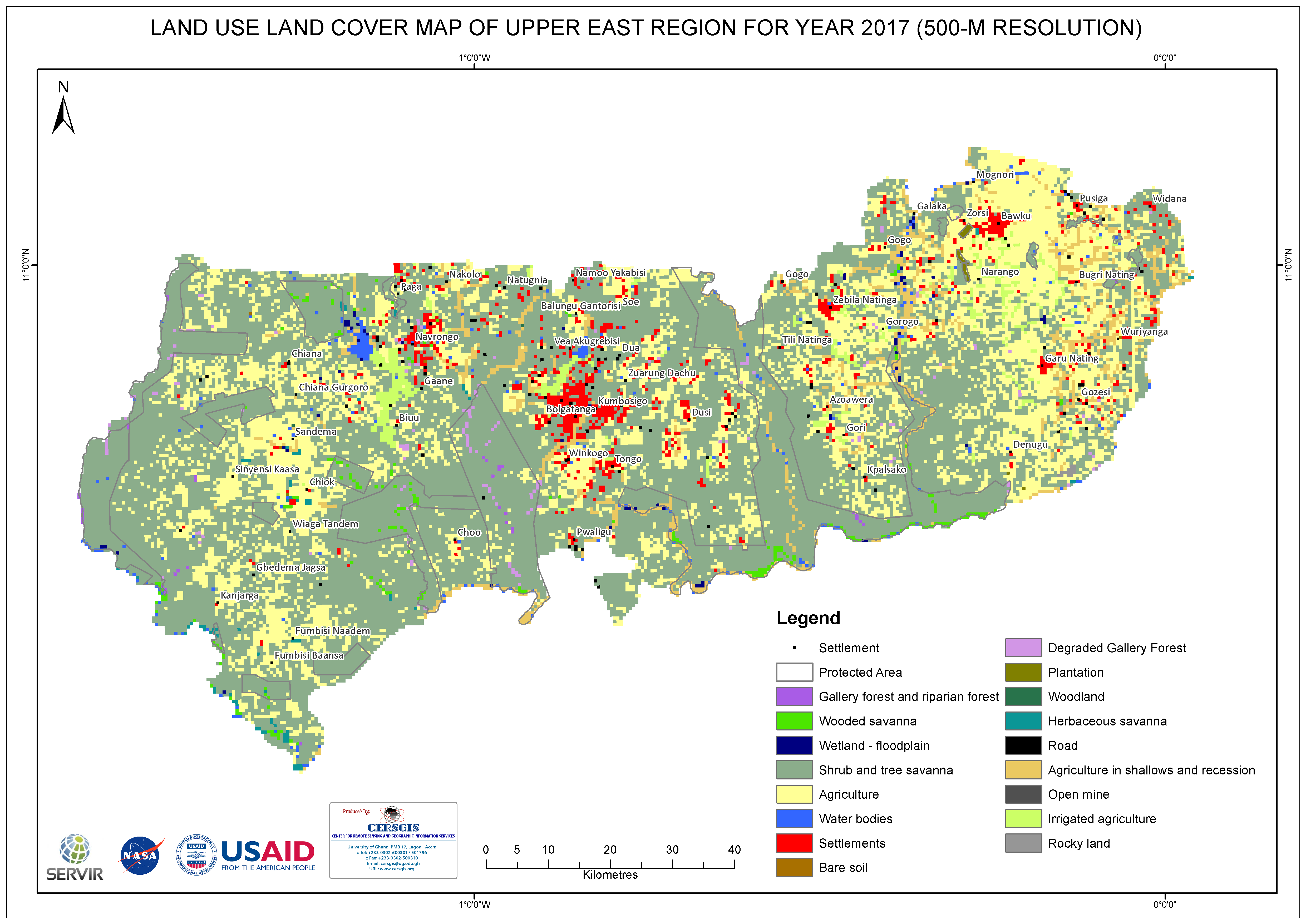
- May 20, 2019
- CERSGIS
Land Cover Map for Upper East Region
This map was developed using a sentinel 2 imagery for October 2017. It is a 500m resolution map that reveals the land use across the region. The Rapid Land Cover Mapper (RLCM) tool, available as an ArcGIS plug-in on the USGS website was used to generate these products.
Download Image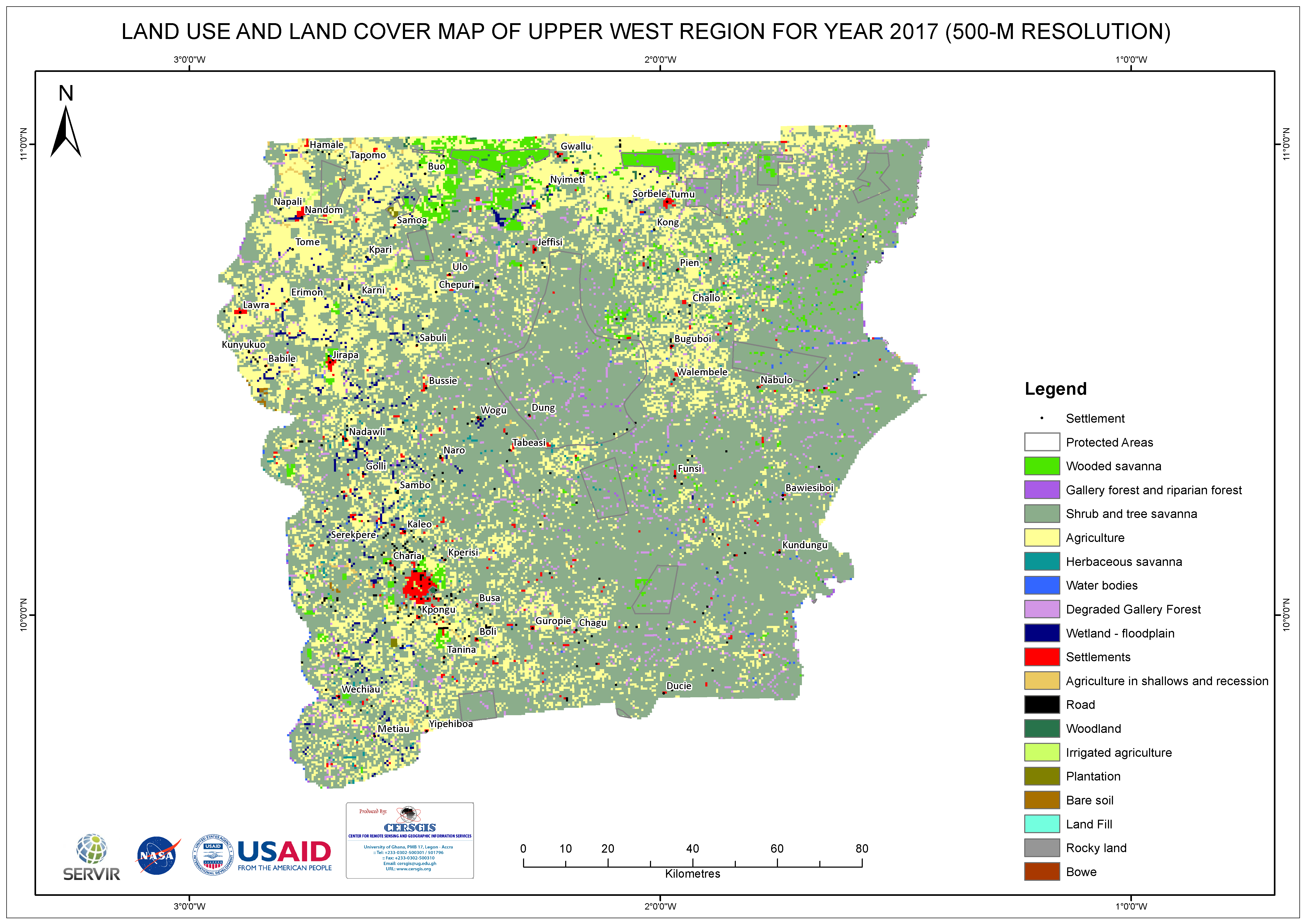
- May 20, 2019
- CERSGIS
Land Cover Map for Upper West Region
This map was developed using a sentinel 2 imagery for October 2017. It is a 500m resolution map that reveals the land use across the region. The Rapid Land Cover Mapper (RLCM) tool, available as an ArcGIS plug-in on the USGS website was used to generate these products.
Download Image